Logo NoiseModellingNoiseModelling


Watch Fork Issue Download


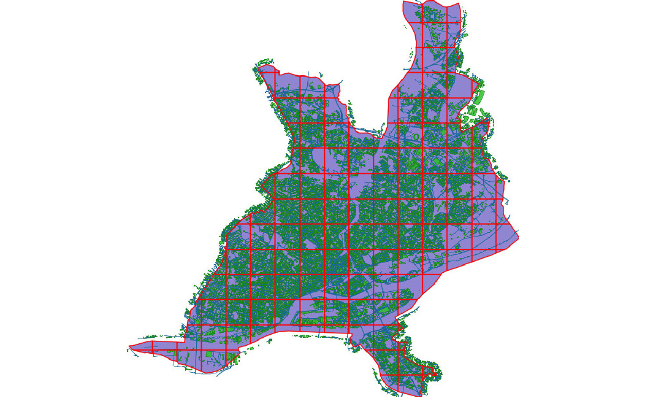
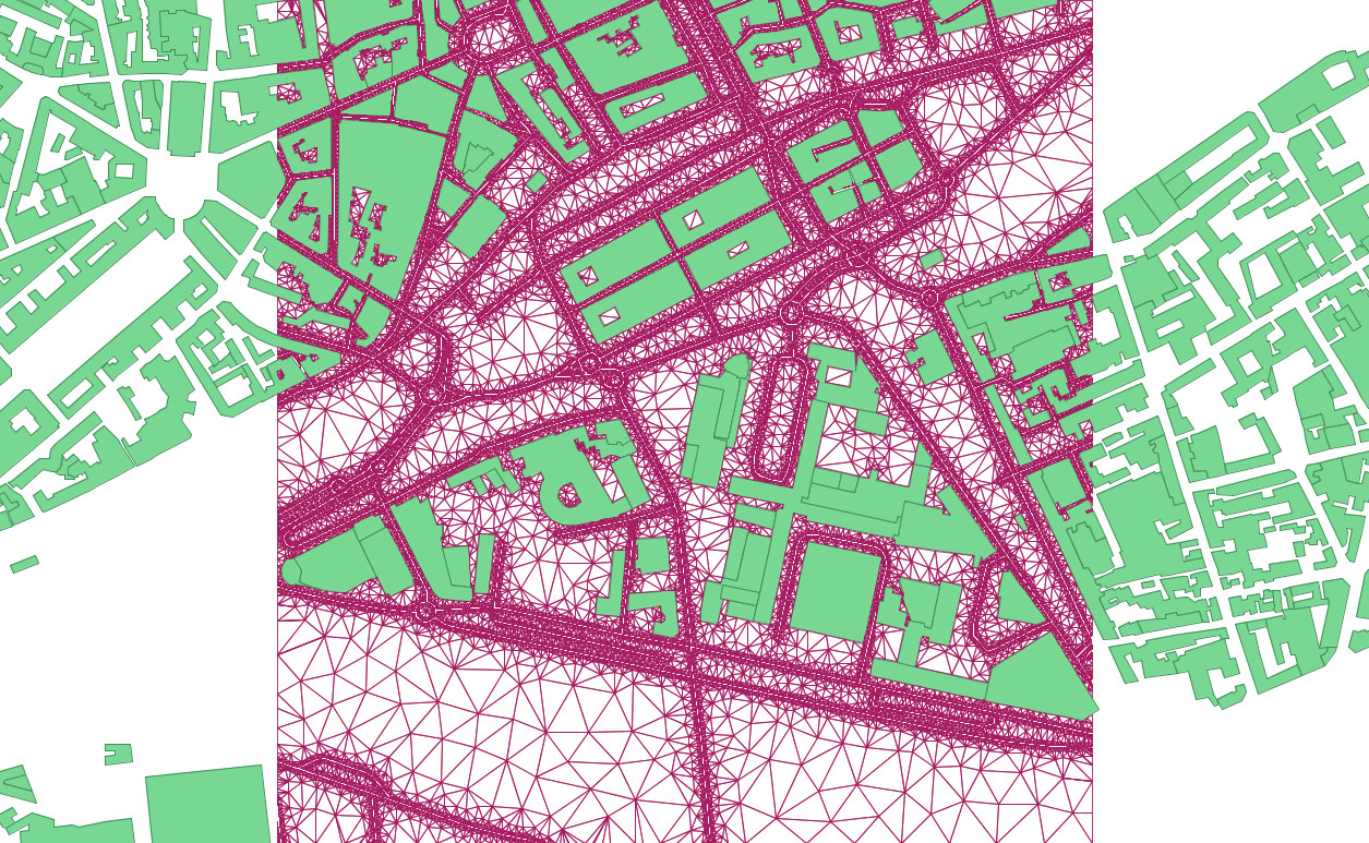
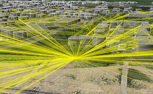
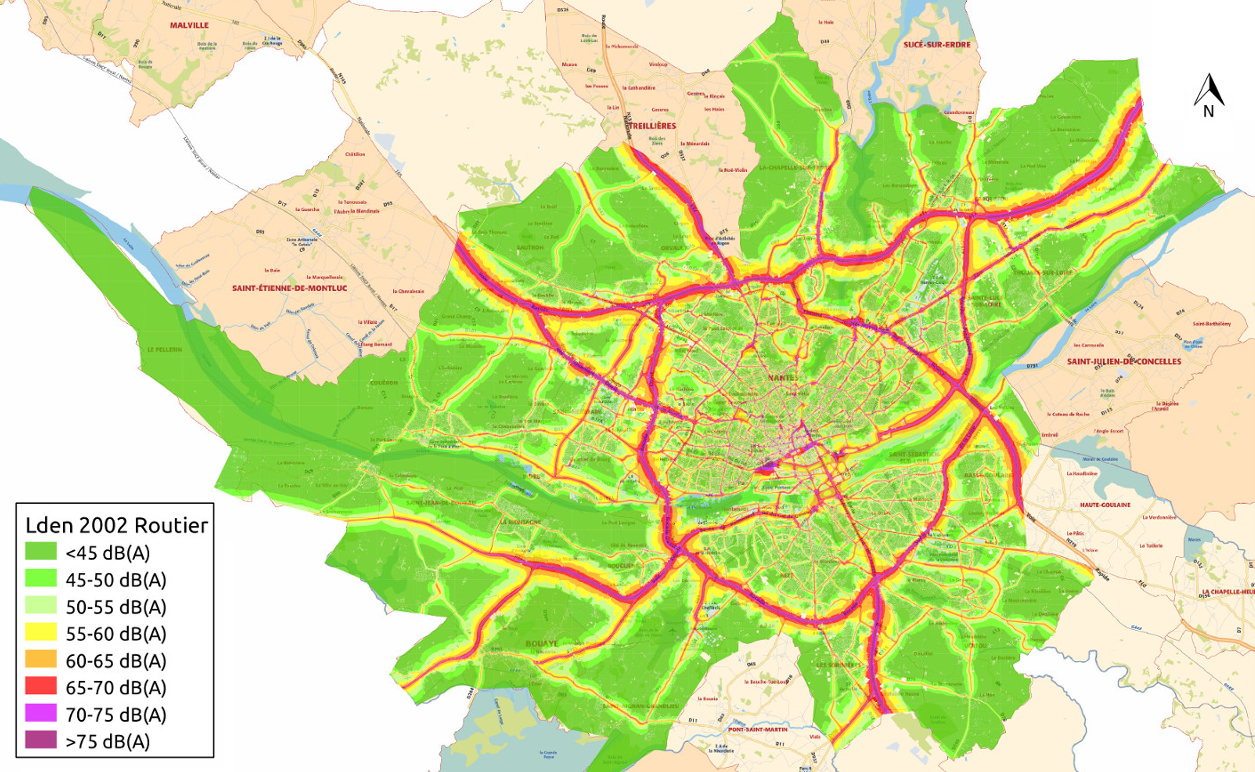
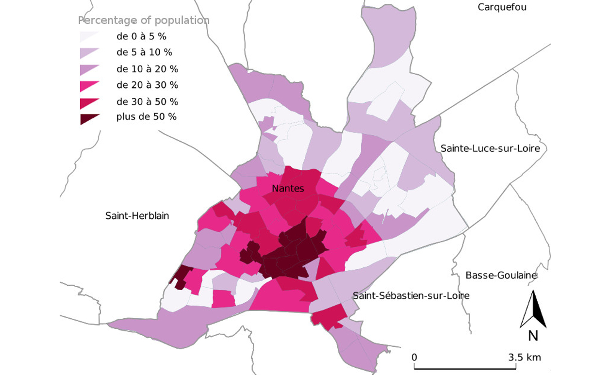
NoiseModelling is a free and open-source tool designed to produce environmental noise maps on very large urban areas. It can be used as a Java library or be controlled through a user friendly web interface.

NoiseModelling is closely paired with the spatial database H2GIS or PostGIS in order to handle a large amount of spatial features. In addition to the operational aspect, this tool is an excellent support for training, teaching and research.

NoiseModelling video presentation


To see more videos about NoiseModelling, please have a look to this dedicated playlist on our YouTube channel.

Further information


Documentation

Interactive documentation that gives you everything you need to know to start using NoiseModelling. In addition, we have produced tutorials that illustrate some common use cases. Have a look!

Documentation

Discussion group

Any questions about NoiseModelling ?
Feel free to join the Github discussion group (for users & developers) and to interact with the community.

Documentation


NoiseModelling in action


DOMAIN
Read More
MESHING
Read More
3D PROPAGATION
Read More
NOISE MAP
Read More
POPULATION
Read More
WPS BUILDER
Read More

Use cases

Below are listed some use cases, where NoiseModelling has been used.
Name Link More
Probabilistic modeling framework for multisource sound mapping See Read
Dynamic approach for the study of the spatial impact of road traffic noise at peak hours See Watch
Sensitivity Analysis & data assimilation See Watch
Captation et Simulation d’Ambiances Urbaines Spatialisées See

Contributors


Institutional


ECN

École Centrale de Nantes

UBS

Université Bretagne Sud

Cerema

Cerema