 History
"Noise-Planet" is a project born from a collaboration, started in 2008, between researchers and engineers, specialized in acousitcs (UMRAE / Université Gustave Eiffel (formerly Ifsttar and LCPC)) and geographic information sciences (Lab-STICC / CNRS).
Below are presented the highlights of this project through a timeline.
-
-
NoiseCapture's first birthday! - 31/08/2018
Already 1 year since the official release of #NoiseCapture ! 🎂
— Noise-Planet (@Noise_Planet) 31 août 2018
So much has been accomplished, thanks to our worlwide community.
Thank you all for your support and participation. This incredible initiative could not live without you 🤩
Made by @CNRS & @Ifsttar @ENERGIC_OD #open pic.twitter.com/DKBoHwLSi0 -
-
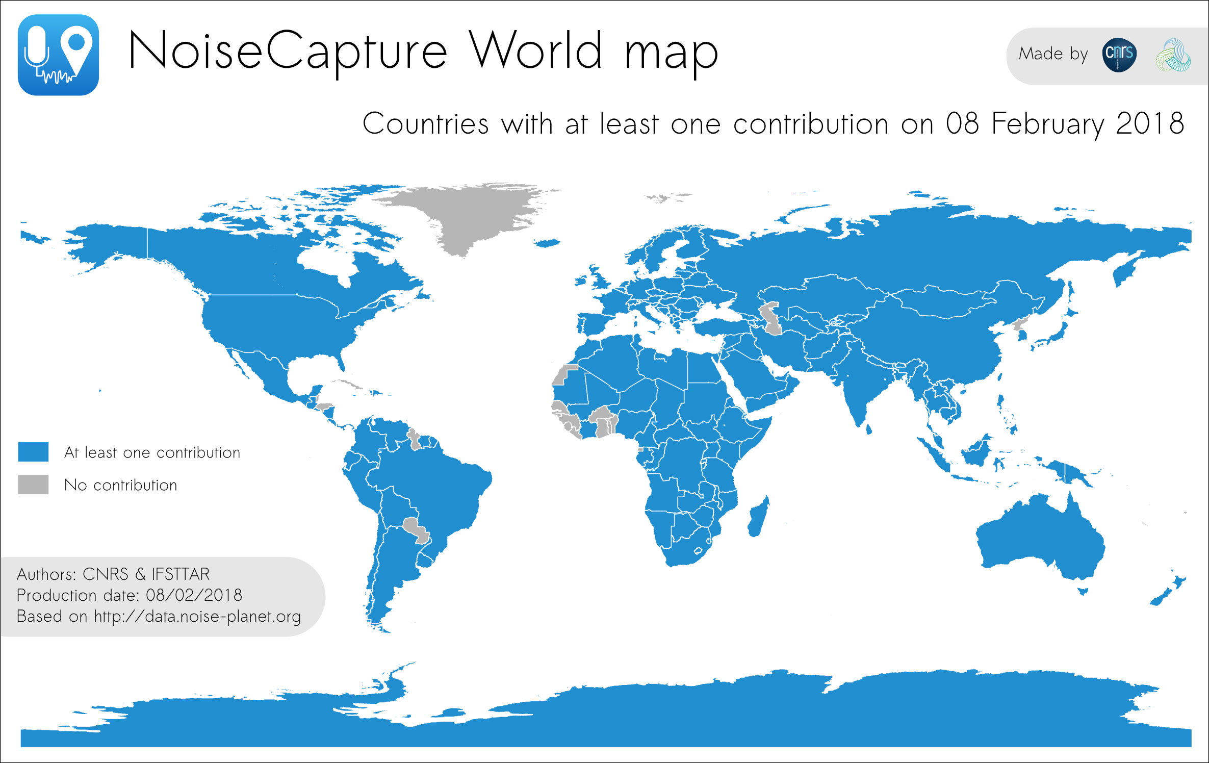
27.000 download of NoiseCapture! - 08/02/2018
#NoiseCapture stats - Updates (Mise à jour) 📢💪📈
— Noise-Planet (@Noise_Planet) 8 février 2018
- 27 000 installations
- 8 575 000 points of measure / 46 440 tracks (traces)
- 175 countries (pays)
- 100 days of measure (jours de mesure)
- App avalaible in (dispo en) 🇫🇷🇬🇧🇩🇪🇮🇹🇪🇸🇨🇳& brezhoneg
🙏👏💙@CNRS @Ifsttar pic.twitter.com/AdP3os2whA -
NoiseModelling & OrbisGIS 5.1 - 01/02/2018
NoiseModelling is now integrated into OrbisGIS v5.1.
-
01dB Acoem & Noise-Planet - 28/11/2017
01dB Acoem and Noise-Planet announce a partnership around the NoiseCapture project.
-
10.000 download of NoiseCapture! - 10/11/2017
-
First public NoiseCapture Party - 20/09/2017
Within the Digital Week 2017 context, organization of the first public NoiseCapture party in Pornichet, France.
-
Official release of NoiseCapture - 01/09/2017
NoiseCapture is available on the Google Play store for all users (not only beta testers).
-
NoiseMap become NoiseModelling - 01/2017
For simplification reasons, NoiseMap is renamed NoiseModelling.
-
Noise-Planet.org is born - 01/2017
CNRS and Ifsttar join forces to create the Noise-Planet project and help disseminating tools.
-
OnoMap SDI - 12/2016
The OnoMap Spatial Data Infrastructure is working.
Within the ENERGIC-OD project (funded by EU and GeoPAL).
-
NoiseCapture - 09/2014
Development of the NoiseCapture application begins.
Within the ENERGIC-OD project (funded by EU and GeoPAL).
-
NoiseMap & H2GIS - 04/2014
NoiseMap is now based on the H2GIS open-source spatial (R)DBMS.
-
NoiseMap new functionnalities - 07/2013
NoiseMap takes into acount the 3D diffraction, the building's heigth and the floor effects.
-
Noise Maps in 2D - 06/2012
End of the Eval-PDU project. NoiseMap makes it possible to create 2D noise maps.
-

